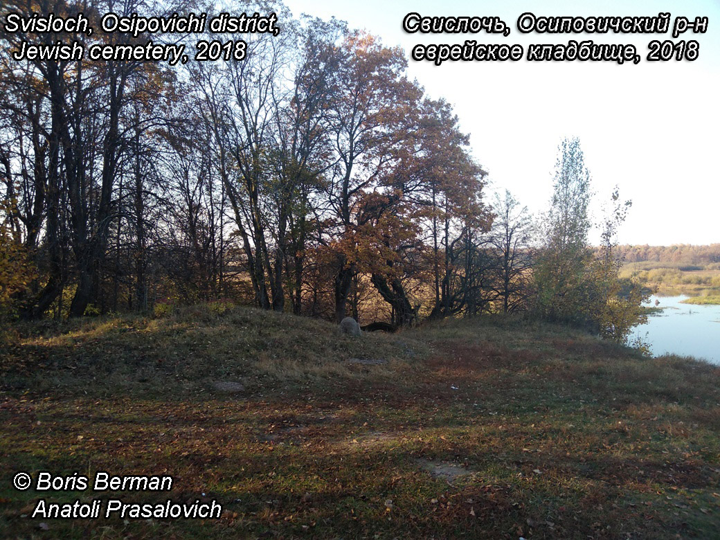
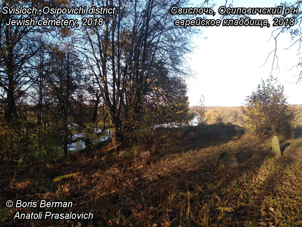
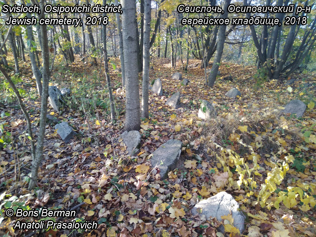
Svislach, Belarus, 53°26' N 28°58' E, 23 miles NNW of Babruysk (Bobruisk). A total photographing of the Jewish cemetery of Svisloch, Osipovichsky district (formerly Svisloch, Bobruisk district, Minsk province) was made from May to October 2018. Total of 292 matsevot were took pictures of - that's all that was preserved and accessible for shooting. Most of the stones, unfortunately, survived poorly and are difficult to read. Several shots were taken on the every spot, including ones with rubbing the surface with sand - these were often miraculously displayed texts. The cemetery is located a kilometer to the NW of the agro-town Svisloch (former shtetle Svisloch) on a steep bank above the bend of the Berezina river.
The coordinates of the cemetery (extreme point near the river Berezina): 53.45306, 28.9571
Link to the cemetery on Google Maps
https://www.google.com/maps/place/Yevreyskoye+Kladbishche.+Svisloch'/@53.4527537,28.9569518,17z/data=!4m12!1m6!3m5!1s0x46d0ae3dff50d605:0xcf8c111893a2bdca!2sYevreyskoye+Kladbishche.+Svisloch'!8m2!3d53.4527537!4d28.9569518!3m4!1s0x46d0ae3dff50d605:0xcf8c111893a2bdca!8m2!3d53.4527537!4d28.9569518?hl=en&authuser=0
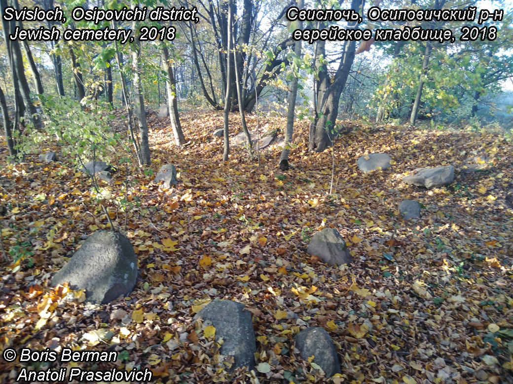
The main part of the cemetery is a plot overgrown with hardwood. Along the edges of the cemetery there are large boulders without inscriptions, presumably to indicate the boundaries. About 10% of the stones are inscribed. Probably, the same percentage of stones went underground, and since the cemetery is covered with deciduous forest with a large number of roots, it is very problematic to invert / remove them.
A number of stones are located directly on the steep bank of the Berezina. Several stones are located over the cliff itself, according to local residents, some collapsed into the river as the bank eroded (one of the interlocutors said that he remembers how 30 years ago bones stuck out of the clayey bank, and the remains were sprouting from the local youth).
Notable is the presence of 3 huge oaks (several hundred years old) in the extreme eastern part, near the road.
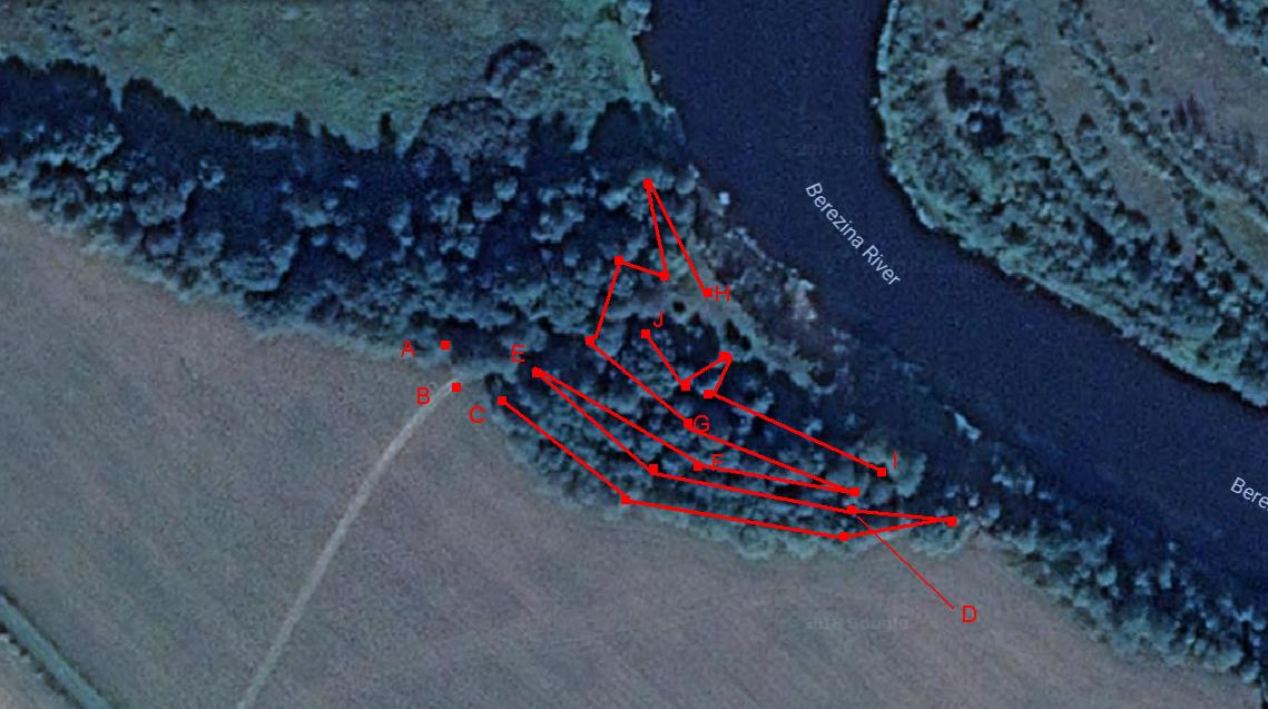
The map of the cemetery (Svis_2018a.jpg) has letters to mark trace of taking photographs, according to catalog numbers.
| 1 - C-D (matsevot 001-049) |
| 2 - D-E (matsevot 050-093) |
| 3 - E-F (matsevot 094-140) |
| 4 - F-G (matsevot 141 - 195) |
| 5 - G-H (matsevot 196 - 249) |
| 6 - I-J (matsevot 251 - 293) |
Data submitted courtesy of BORIS BERMAN (initiative, organization, funding, Photoshop processing, translation).
Pictures taking – Anatoli Prasalovich.
Hebrow reading and translation: Mordehai Motola, Arie Parnis, Lubov Gil, Yuri Chertkov, Mendy Deitsch.
Cemetery map
Cemetery overview
Another overview of cemetery
Third overview of cemetery
Fourth overview of cemetery
Fifth overview of cemetery
Sixth overview of cemetery